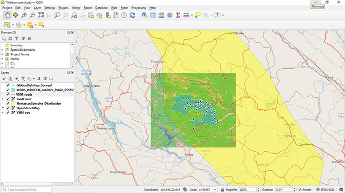
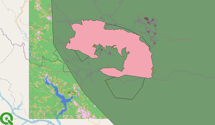
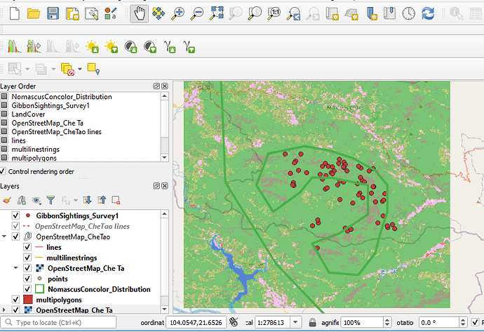
Wow Megan, I like your map!
I have learnt about data categories (rasta vs vector) and which type of data falls into each category. I still struggle with determining uncertainty in data, but this may become clearer when I am applying it to my own data. Overall I feel like I am progressing and am more confident with GIS than before starting this course.
So far I have not encountered any major problems, but the instructions provided by the course make it easy to learn.
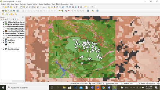
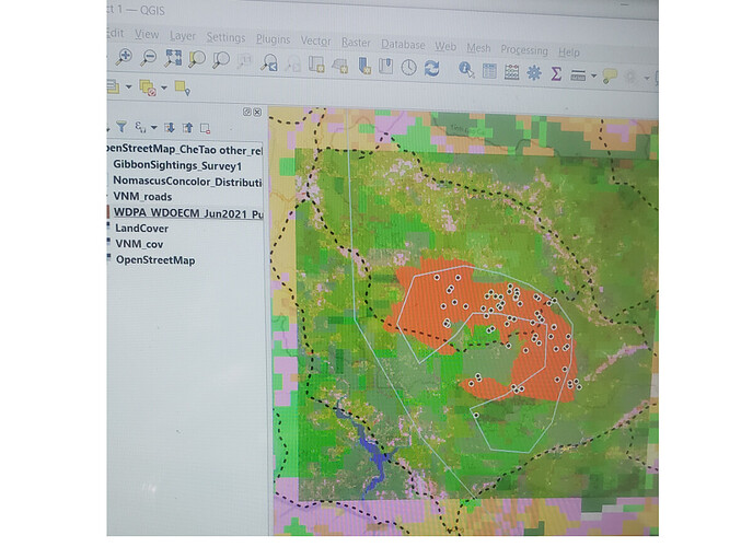
I really like how you have altered the colours of the VNM_cov layer and made it transparent. I was unable to figure out how to make it transparent or less opaque on my map - Do you have any suggestions?
This module was a bit more complicated than the previous one but fortunately, I still got to complete the activity. I learned about the difference between raster and vector and which of the two would be more useful for my own field study. I found out about the high or low resolution datasets and the definition of the extent of the data set. I encountered minor difficulty on downloading all the files needed for this activity.
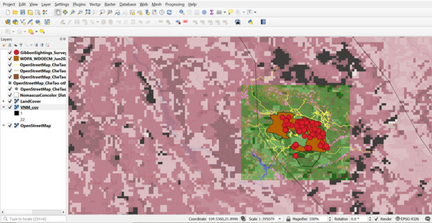
With the help of the quizzes in these modules, I’m able to comprehend the differences between raster and vector layers more clearly. Hence, this module develops my critical thinking on how to fully understand the concept. I have undergone a few trials and errors to have this presentable map.
I hope I successfully do the correct one. Thank you.
I really like the color choice of your map. This made your map clear and well present!
Hello there,
Your map looks great! I suggest you adjust the transparency of your VNM_cov layer and play around with its color a little bit. I also suggest you fix your layers so the other layers would become more visible. Overall, you did well considering you’ve encountered some technical difficulties. Keep it up!
Hello! Finally I’m done with the module 2 and very completely new to this kind of work that it make me realized that it is really super complicated and I really find it hard since there are lots of data that need to be considered in making this assignment. Another thing is the instruction given it makes more complicated to follow, but as of the moment i realized the difference of the vector and raster and it is used in the project.
That’s all for this module! I hope you also feel what I’ve felt. See you on module 3!
Thank you
The work looks so good congratulations
Hellow mates, in this module I solved all my questions that i asked my self in the first module, at first the assigment was a bit tough for me, however hel help from my mates made the study to be easier and finally i did it.
Hello.
I still have issues with importing the Raster file, i presume the format is not acceptable.
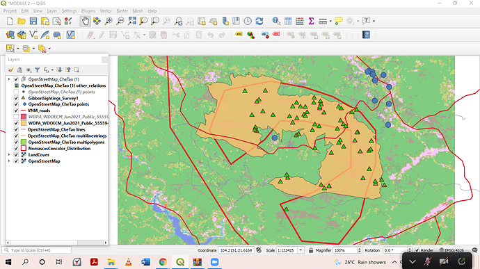
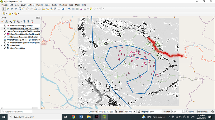
This is what my map looks like.
Please, assess and correct guide me.
Well, i can say i am heading towards the right direction and in the positive way. this module was a brain teaser and a wake up call for me. However, it was a bit confusing for me at first especially when adding the CheTao data because it kept popping up a dialogue that required me to select all, and the more i selected the more they where on my layers. but after i think i got what i was looking for, i went back and turned off each of the layers one at a time to know the repeated ones and i deleted those ones leaving me with the few ones there. After that, i brought all my raster data down so they form a background which i show forth my park, sightings and the roads. I hope i have done the right thing though?
I had the same too…I have tried playing around it but could not discover the reason.
I found the more finer grained layers made for better maps that as they offered more detail.
I had a problem adding the final .shp file as I was using add layer - add raster, which generated an error message saying the file was not supported.
To fix this problem I dropped the file straight into the layer menu and that seemed to work.
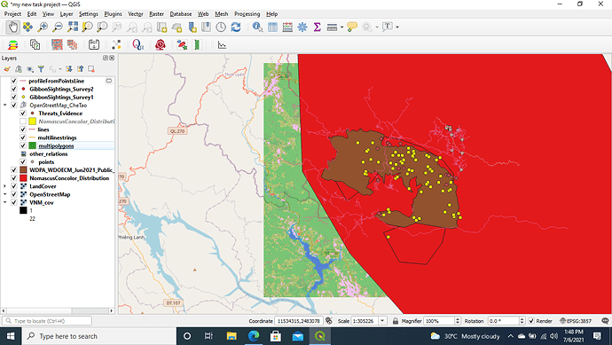
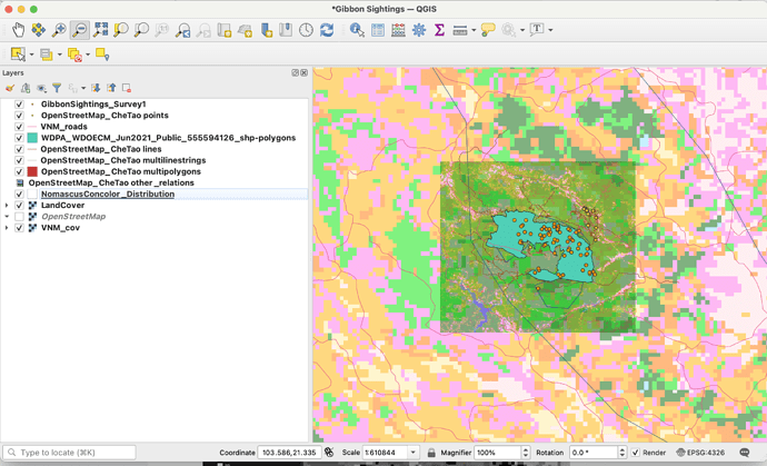
I wasn’t really sure if I did this right but I came up with this output. I tried my best adjusting the lines, changing colors and capacity but I couldn’t still make it look like the majority of the uploads here. I had a lot of trials and errors but still I ain’t give up. I am really desperate on learning this.
On the other hand, I was able to differentiate raster from vector. The only problem was on how I am going to do it with my map.
Hope someone could help me.
My kind regards.
Hello, I am also having the same problem. Files aren’t acceptable. Hope we can make it before the end of the class. God bless!
Dear Lucy,
I am sorry that I have been late in recent time due to some office engagement.
Please, I try uploading the layers (VNM, Che tao, and the rest of the other layers) on my map but it is not working. Am confused. Probably I am not doing something right. I have tried and cant get it. I need your help please. I want to do everything in this two days to catch up.
Lormie
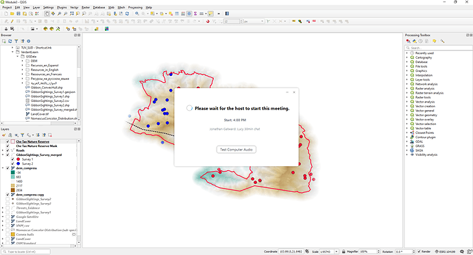
@mama_lor - How are you trying to upload the layers ? Have you downloaded the layers and have them on a folder on your laptop/computer ? Are they visible in the “Browser” panel of QGIS see image
Hello Jonathan,
Thanks for responding this fast. I have downloaded the layers and save it on the laptop. but whenever I try to add the layer it doesn’t load on the map.
