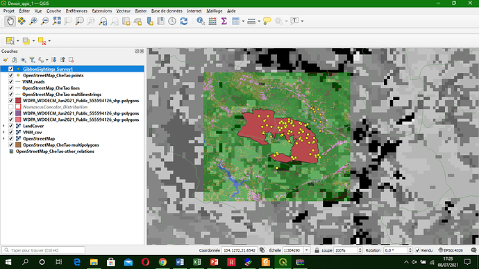
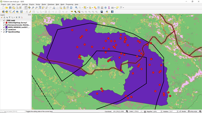
Your map looks good. I really struggle through this module. I need to keep trying.
This module was interesting and challenging. I enjoyed the readings but putting it to practice was quiet challenging. I hope my output looks like the expected outcome? I think I should keep practising.
Good job YWChan. however I suggest you to change the colors of your vector layers
Hi Everyone,
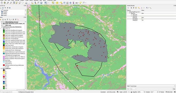
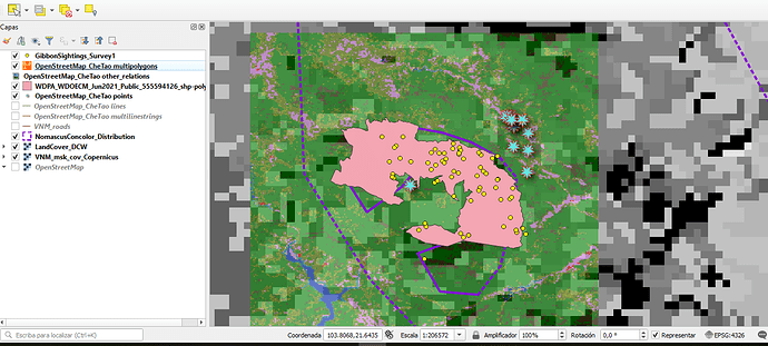
Something I found difficult in this module was getting to grips with all the different layers and what information I wanted to show but with a bit of trial and error I think I’m getting the hang of it. Organising all the different layers is an important step towards my learning goal of understanding the basics of GIS.
Hi Anna
Great work! I like that you have the fine scale reserve boundary distinct from your background. I think I could learn from the simplicity of what you’ve selected to include out of your layers (my projects seem to get a bit cluttered). I would suggest making your gibbon survey points a more contrasting colour so they can be more easily distinguished from the reserve.
Hi @Pye I’d definitely say you’ve got the hand of it - the map looks great and nice and clear.
Good choice on colours too to make sure everything stands out and is easy to interpret
I came back to redo this module as I was having trouble with it before. I think my problem came down to my save folders getting messy with the zips- in any case, I got it this time!
I’m going to try to reorder layers some and try out some new Symbol styles with color, to make it look a little more cohesive- I’m glad to finally have all the information on there though.
I’m looking forward to the point when I can immediately know exactly which layer type each type of file is supposed to be.
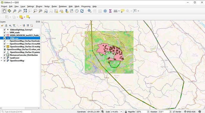
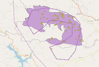
In this module I have learned the difference between vector and raster data and its types. how to arrange the layers in the panel and some good websites to find shapefiles. Can’t wait to make such map on my own. In this map, it is seen that a road is dividing the protected area into two.
Hi Grace,
I like that you have really explored different styles of symbology in your map.
I think you could move the roads layer on top to make it visible over the other layer.
it reminds me how important it is to align the layers in proper order.
The activity was illustrative in the sense that you can see how much difference resolutions of data sources makes. This helped me to always think at resolution before drawing any conclusions about a map. For example in my map you can see that there is a big area at the southern corner that does not match between the distribution and the extent of the protected area.
Hi,
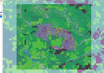
Yes, you have a good map design, you can see the difference in grain size for both raster and vector files in your map.
As a good practice you can make different subfolders in your project folders for raster, vector, project file and map outputs (soon to come). Also feel free to rename your files to something that makes sense to you. Rule of thump there is to usually avoid spaces and use an underline.
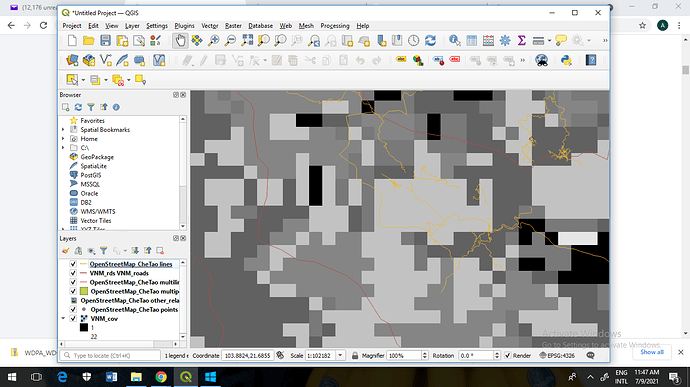
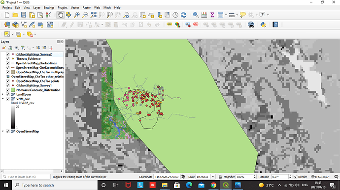
This module was was difficult for me. I struggled with a lot doing my assignment. I was not able to access the Che Tao Nature Reserve.
Your work looks so good. How did you insert the Che Tao Nature Reserve in your Map?
Module 2 has been a good next step for me as I refamiliarise myself with how to find and import a range of raster basemaps. Being able to compare the detail bewteen the different resources we have been directed to has been useful. This is directly relevant to both my work and study as I think about the best way to display spatial data for both native species distribution and introdcued predator control across the different sites where I work. The sites and the corresponding data points I have from each all vary greatly in scale and the sort of resolution that will be required for each area to inform our management decisions, ranging from nest locations and nesting success across individual seabird colonies, through to catchment scale introduced predator and native species distribution.
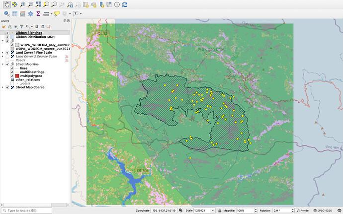
Hello. Me too, one thing I found challening was deciding which layers were the most useful to display, especially as the differences were quite sublte on some of them. You have chosen nice clear colours in your displayed image and by having the fill of the Nature Reserve hased rather thsn solid it makes the unserlying layers visible which is much better than the soolid fill I used, I will go back in now and change this! Thanks.
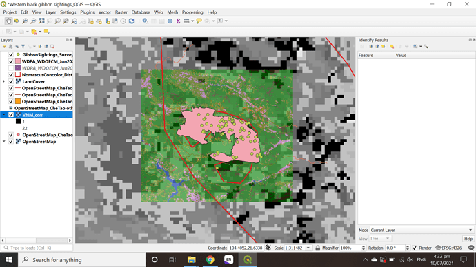
Fine vs coarse resolution limits of reserve. The finer-scale dataset more closely encompasses the gibbon observations, although both have the same general shape.
Fine vs coarse landcover data. I played around a bit with colouring the coarser-grained dataset, and changing the transparency to make it easier to see alongside the fine-scale data. The coarse data is so coarse, it’s hard to compare it to the fine-scale data! I am sure changing the visual aspects will likely make patterns easier to see. This is definitely hard to interpret all together!
Oh, I really like that you made both landcover datasets greyscale - makes it much easier to compare than my chaotic colouring!
-
I’m pretty excited about what I’m learning from this course. Learning how to use and understand the different geospatial data models is a great advance to my goal.
-
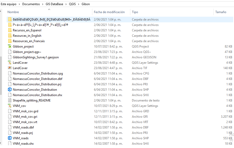
When I was organizing the downloaded data I create more folders to differentiate the sources where the data was coming from, but this turned out to be messier or untidy, so I decided to move the archives to the main folder and delete the extra folders, but when I open the QGIS project an alert message showed up telling me there was a problem with my data sources. It was easy to solve this problem because QGIS have a tool to ‘Auto-find’ your data sources, if they are in the main folder where you save the archives (I don’t think this would work if you loose or deleted the files).
I had some similar troubles. You have to download every single file that has a link, put them in the main folder always, and be careful about the steps about unzipping files, because that may be tricky. I suggest you try to do it again step by step from the begging and try to identify every single download file. I’m going to show you my main folder for this project and you can compare if you have all the files required to complete the assignment.
