This is really nice, I like the fact that there are many ways of representing the earth too and the choice of mothod of projection depends on the purpose of the map or the features you wish to preserve.
This is my first time manipulating the SRS. I know this is important but did not know that it affects many things. The projection concept is new thing for me as well as the way to convert to another format, saving as new file, and merging the data. Thanks!
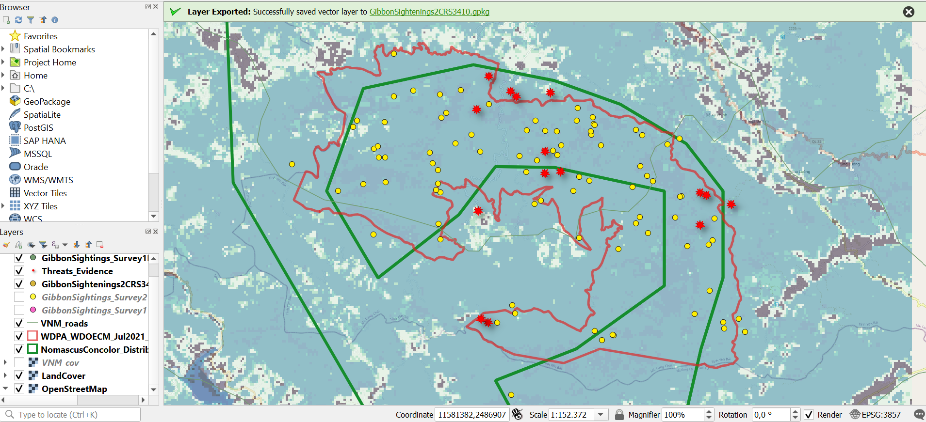
That’s awesome. Agree with Jacelyn, that might be your CRS projection. You can pan the map to the selection and zoom to the plotted points.
Hi cj_mcc,
you did good job with your maps. But i suggest that you can used colors like skyblue, yellow, or yellowgreen to your symbols so that it can easily seen and identify. 
Hi @janew , love your map. It is so special and different from others. Good Job
he SRS (or CRS) used is dependant on where abouts in the world your project is, the area of study (global, national, regional site specific etc) the type of data you are using and where it comes from (eg. national mapping agencies, GPS, global datasets etc) and the purpose of the map you are going to produce (The standard Transverse Mercator projection that has been accept as the “normal” map of the world was designed specifically for east west travel across the oceans hence lines of longitude remain constant. Its not much good for exploring polar regions or to give an accurate representation of land mass on a north - south axis).
In the UK, we have the British National Grid, on which all our national Ordnance Survey maps are based, but this is a different map projection to lat, lon so co-ordinates provided from GPS need converting, and it is impractical for detailed construction work (hence local site surveys for building works are often on a local grid covering the area where the building is going to be.)
Our own UK national grid is also doesnt extent to Republic of Ireland (even though the two countries are close together and adjoining, so any mapping project that covers both Republic of Ireland and Britain would not work with either of these two natinonally recognised projection systems - a UTM based projection would therefore be required.
It IS a very complicated issue but as a general rule, use one of the WGS84 projections for global datasets (Google Earth and other online global mapping system use WGS84 Pseudo Mercator) and co-ordinates supplied as Lat, Lon, in the absence of any prescribed natinoal projection (eg British National Grid) use the UTM zone appropriate to which ever area of the globe you are studying
1 Like
This looks great! Its clear and neat!
This module was very interesting! There are a lot of new concepts I learnt here and some, I have to admit< I have to go over again  But overall the module was not difficult to do! Still learning.
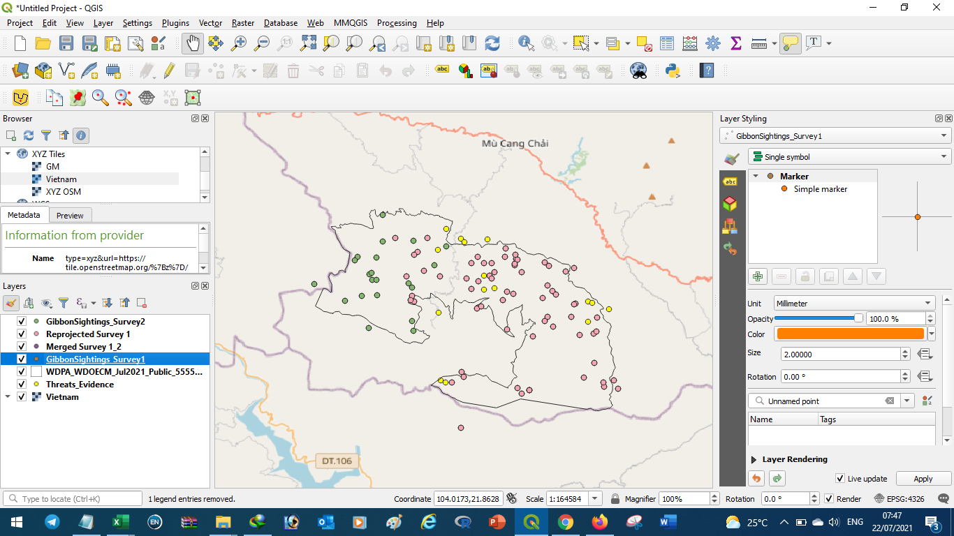
My assignment 3 went very well because I have been able to apply the information that I have learned from module, I have notice a little bit of change but most of the things are almost similar which helped me soo cause I took me time to complete this assignment. The challenges I faced I was struggling to choose which coordinates falls under latitude or longitude, I have resolved it by going back to my notes reads reads with understanding. I have learned that I have to know which src to use, merge my data information in one file. I have learned that QGIS is not only about collecting data from the field must also be able to represent it in point of co ordinates to know the exact locations for occurrence such distributions, location of certain species.
I have learned how to play with different colors symbols for more visibility of my map.I must be very careful when choosing colours because same may fade others if not chosen wisely.
Janew great map presentation everything is clear visible I wanna visit your your study already just by looking your map.
Well attempt …you have tried to put all the layers as indicated in the module
Hi everybody, here my assignment for the Module 3;
It was interesting to learn how to reproject a layer and how to merge it, this module raised a lot of additional questions in my head; there are CRS that are not compatible for reprojections? are CRS related to geographical areas? Will I be able to work on maps and data in an arrea with different CRS ?
I guess I will find out more in the next module!
Thank you, your post answer to some of the questions this module raised in my head.
So your suggestion is to find a local/national map and use its CRS? (maybe I misunderstood )
I was a little bit confused by how to really get the correct reference system but thanks to you guys have managed to get it on point.
To me i find the module a little bit challenging although I managed to go through it all…More practice will really help.
well done, excellent choice
Hello Dessiew
You did not correct the problem I commented on in module 2 assignment, so the problem still going to module 3 assignment.
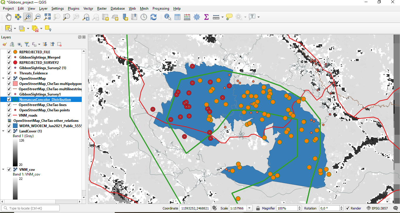
If you reorder the layers, it will improve their visibility.i.e point vector (GibbonSighting Survey at the top), polygons vector (NomascusConcolor Distribution) at the middle and raster layer (Land cover) at the bottom. And also you didn’t add the Che Tao Nature Reserve boundary from protected planet.
Very informative and Clearly seen. Excellence
I think it’s a great idea to redo this module or any of the modules to really understand and remember the important lessons. I too had to redo this module because I was having a hard time understanding what reprojecting to the same SRS means and why we had to do it.