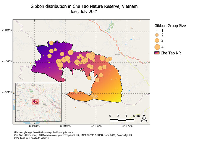
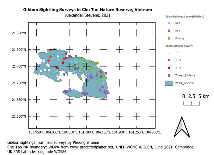
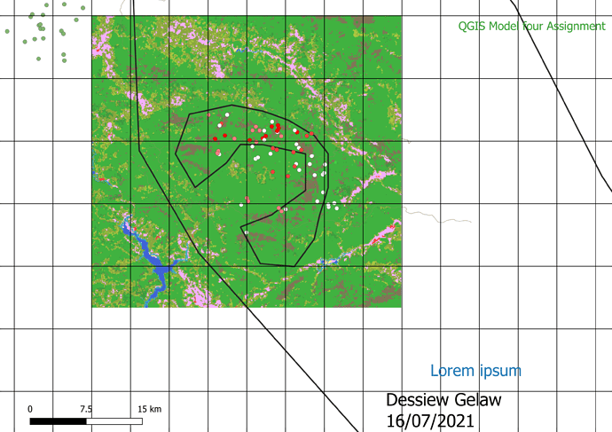
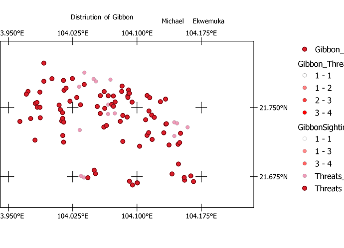
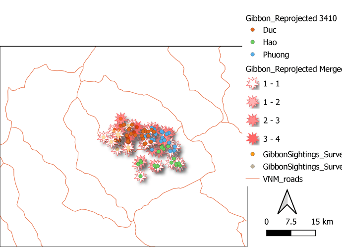
the map looks nice, by showing the overlapping between point and layers makes it easier to understand the message
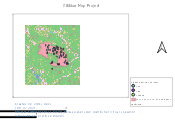
I have exported this map but I have got a number of challenges in adding some of the components on the map. For example when I was adding the scale and grid, do not appear as I work on the map. Could this be because I missed out on certain instructions or my QGIS has a problem. Any help is highly accepted. Otherwise the progress of my learning has been very good and my objective was develop a map of my own which I think am almost there. However I still need to learn how to make my own datasets for my to practice map development.
This module was challenging but definitely fun the more times I got it wrong lol. I did an overview in the inset map but I’m not sure if it really shows where the reserve is located. Is there a way to make the overview wider or make the inset map more useful?
Great stuff Dhivya  i should have added the threats to my map too
Today`s activity was indeed challenging for me. Had difficulties in having coordinates, scale and key. I know that there is somewhere l missed, but l tried out all the steps. I hope i will get guidance so that l try it out again some other time. Learning took place, am grateful for having this module
This so cool and up standard. You did well. How did you do it to get to the key, scale and coordinates. Had challenges and l did mine poorly. The last module was a bit challenging for me. I hope l will get guidance. Good work on yours.
@Tandie - if you want to message me direct or email on jongatward@ntlworld.com, may be I can help a bit more. The key to remember with the scale bar and the grid is that you need to set the CRS to be the same as teh project CRS otherwise unexpected things will happen !
@joelashervin - If your overview map is another “map element”, then you can set this to be any scale or extent you like, so you could zoom out to view the whole of Vietnam.
@Asiku_Jimmy - When adding Grids and scale bars, there is an option in both to specify the CRS you should use. Normally this should be exactly the same as the CRS used in the QGIS Project.
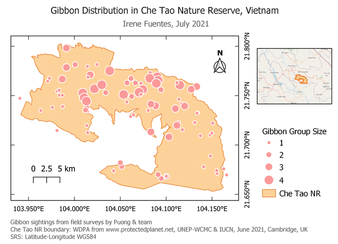
In my map I chose to show the gibbon distribution classified by group sizes. I had some trouble trying to found out how to modify the gibbon sightings so it would appear in the legend properly grouped; but finally I could fix it and it even wasn’t that dificult. Also, once you’re making the map it is very thorough, but it can be amusing.
This course has helped me consolidate the knowledge I got in university about using this great tool as is QGIS, but also it let me learn some new details I didn’t learnt before, in practice as well as in theory.
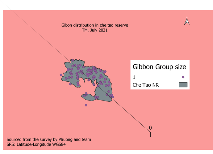
@Lmaliwa - It looks from your screen shot as though you have got your layout “Page size” set too small (or your Map Element too big !).
All the elements you have for your final map need to be within the “page”. If you think of your “Page Setup” as the size of the piece of paper you would print this out on (eg. A4 or A3), then you can arrange the different elements on that single “Page”. When you export it or print it, then the legend, scale bar, north arrow etc, will all fit on the single “printed page”. If the elements are not on the page, then they will not be printed/exported. Hope this helps.
Hello Michelle! I think your map look great! I like the crosses in it, I will use them in my next maps!
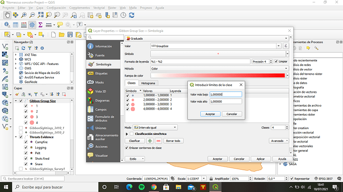
About what you ask, I had the exact same problem and I got a little crazy trying to figure it out 
Here’s an screenshot of how my layer’s propeties’ window looks like after I solved it:
If you double click on the different values (p.e. “1.00000-1.00000”), it will appear the pop up window you see just on the righ of this values, where you can modify them.
If you still have trouble with this don’t hesitate to ask and I’ll try to help!
I thought that this final assignment was very interesting in that, it put all the techniques and ideas together in a map that illustrate your data effectively. I found to be the most challenging part was formatting the map so that it shows all the points and scales so that it fits on the paper. Also, I just learned that after making changes after saving it as a image it doesn’t update your changes and you can loose your work. I am still not sure how to insert the smaller map so that it shows different layers than the main map.
One thing I would like to learn is how to turn this map into a geo-reference map so that it can then be used in the field.
I find your map to be a great picture depicting everything clearly and non-distracting. I don’t think that I would change anything!
Here is my model 4 Assignment and it was difficult to me by different causes to made this map but after a great efforts I made it as much as I can
Thank you so much, Alex 
Best wishes!
Of course, you too! 
Firstly, let me apologize for the late submission of this module’s assignment. I have been in the field, collecting data for my work and unfortunately, I have no access to internet connection. I just returned yesterday, and after some rest, I felt doing the needful.
Like I previously said, it will only take several practices to master this process of creating maps. This is quite evident in my recent work where I developed the map. I could play with various tools and layers and watched how they affect the design of my map. Why I felt very elated in doing this, I encountered very vital issue, laying of grids and ordering of legends on the map. I tried using the specification you gave but unfortunately, it did not come out as it ought to. Aside that, I feel I am on track with other components of the lecture series.
Thank you very much Lucy and also to all colleagues whose meaningful contributions had impacted my development in the course.
Cheers!
Great Map @Dessiew-Lal. I have only observed that the legend is not there
This is Fantastic Irene. Congrats on a Job weldone! It will be nice if you can share with me the steps in developing the other map.
Bravo!
